 Skip to content
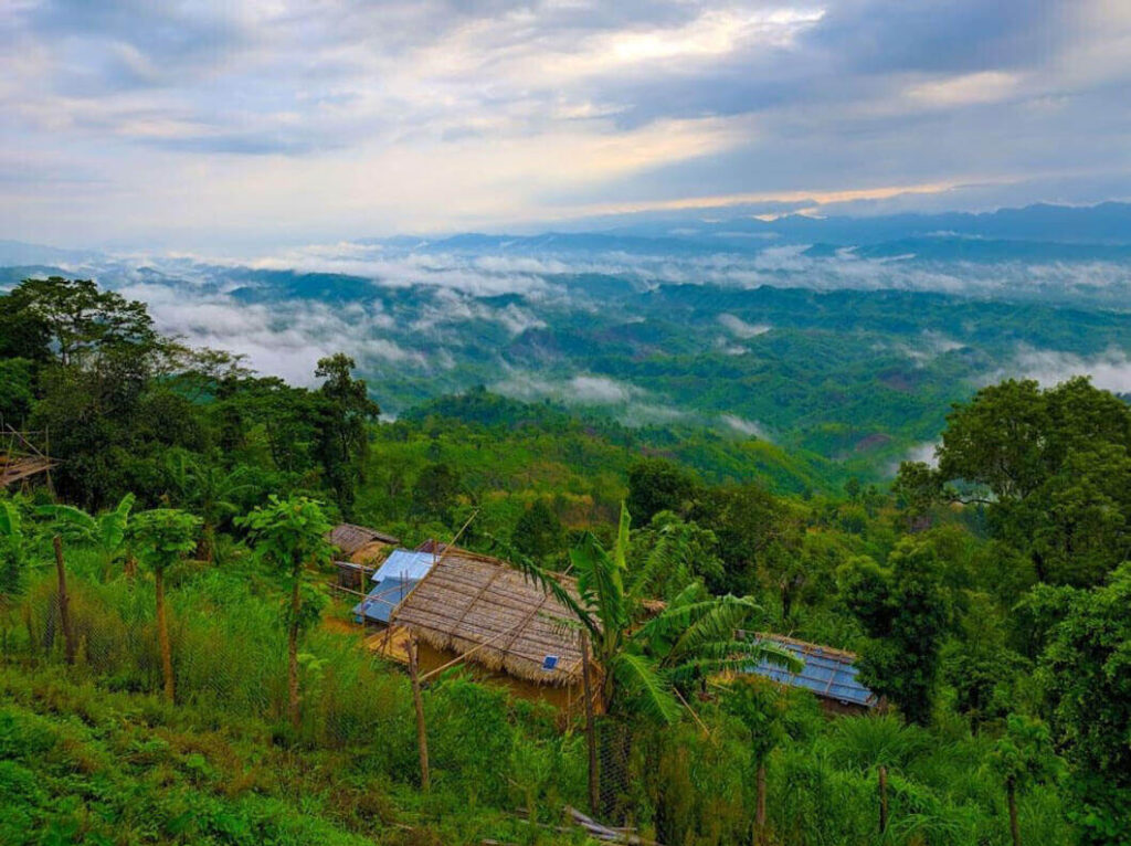
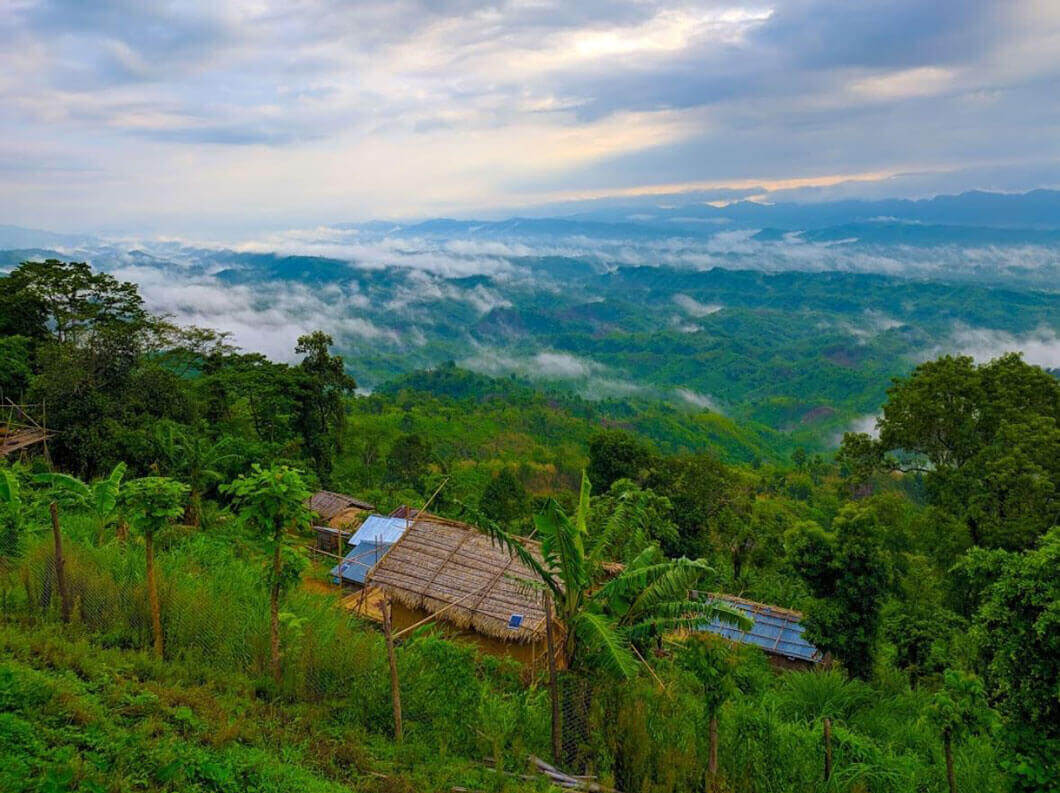
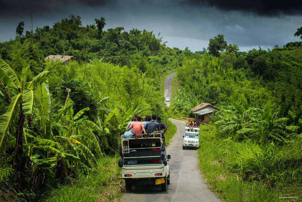
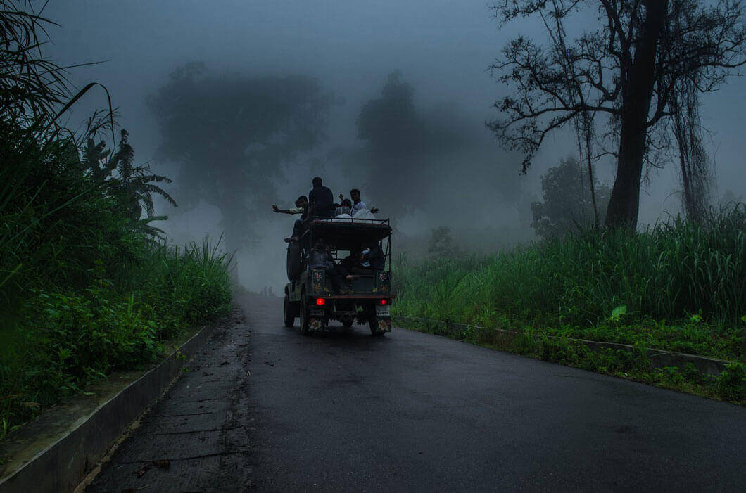
Sajek Valley is known for its natural environment and is surrounded by green mountains, dense forests, and hilly terrain. Many small rivers flow through the mountains, among which the Sajek (also Kasalong) and the Masalong are notable. On the way to Sajek Valley, one has to cross the Mayni Range and the Mayni River. The road to Sajek features steep inclines and descents.[2]
Geography
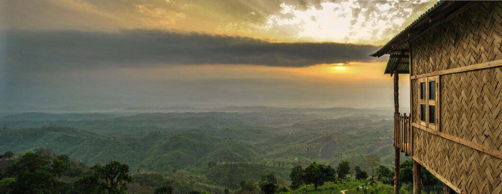
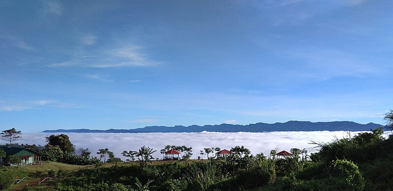
Sajek Valley is situated within Sajek Union—the largest union of the country by area—positioned in the northern region of the Chittagong Hill Tracts, among the Kasalong range of hills. It falls under the administrative jurisdiction of Baghaichhari Upazila in the Rangamati Hill District, situated about 70–80 kilometres (43–50 mi) from Khagrachhari.[7][4] The valley is located close to the Indian border state of Mizoram, surrounded by the hills of Mizoram on the east and Tripura on the north.[4] It rises 1,800 feet (550 m) above sea level.[5]
Sajek Valley is situated within Sajek Union—the largest union of the country by area—positioned in the northern region of the Chittagong Hill Tracts, among the Kasalong range of hills.
Environment
Sajek Valley is known for its natural environment and is surrounded by green mountains, dense forests, and hilly terrain. Many small rivers flow through the mountains, among which the Sajek (also Kasalong) and the Masalong are notable. On the way to Sajek Valley, one has to cross the Mayni Range and the Mayni River. The road to Sajek features steep inclines and descents.[2]
Geography
Sajek Valley is situated within Sajek Union—the largest union of the country by area—positioned in the northern region of the Chittagong Hill Tracts, among the Kasalong range of hills. It falls under the administrative jurisdiction of Baghaichhari Upazila in the Rangamati Hill District, situated about 70–80 kilometres (43–50 mi) from Khagrachhari.[7][4] The valley is located close to the Indian border state of Mizoram, surrounded by the hills of Mizoram on the east and Tripura on the north.[4] It rises 1,800 feet (550 m) above sea level. We don’t source a loan and leave you to it … our commitment is to become your financial partners that work with you at every life stage and financial phase now and into the future.
Geography
- Find-out Weak Area & Outrank Competitorsy.
- Find-out Weak Area & Outrank Competitorsy.
- Find-out Weak Area & Outrank Competitorsy.
- Find-out Weak Area & Outrank Competitorsy.
- Find-out Weak Area & Outrank Competitorsy.
- Find-out Weak Area & Outrank Competitorsy.
- Find-out Weak Area & Outrank Competitorsy.

Settlements


Types Of Services We Provide
The inhabitants of Sajek Valley comprise various ethnic minority groups, including the Chakma, Marma, Tripuri, Pankho, Lushai, and other indigenous communities. In this community, there is a notable involvement of women in economic pursuits, particularly in activities such as fruit and vegetable picking. While proficiency in Bengali may not be widespread among them, the younger generation often possesses some degree of proficiency in English.[2]

how to choose cleaning service

how to choose cleaning service
how to choose cleaning service
how to choose cleaning service
how to choose cleaning service
how to choose cleaning service
Settlements
how to choose cleaning service
how to choose cleaning service
how to choose cleaning service
how to choose cleaning service
Settlements


Geography
Sajek Valley is situated within Sajek Union—the largest union of the country by area—positioned in the northern region of the Chittagong Hill Tracts, among the Kasalong range of hills. It falls under the administrative jurisdiction of Baghaichhari Upazila in the Rangamati Hill District, situated about 70–80 kilometres (43–50 mi) from Khagrachhari.[7][4] The valley is located close to the Indian border state of Mizoram, surrounded by the hills of Mizoram on the east and Tripura on the north.[4] It rises 1,800 feet (550 m) above sea level.[5]
Settlements
Geography
Sajek Valley is situated within Sajek Union—the largest union of the country by area—positioned in the northern region of the Chittagong Hill Tracts, among the Kasalong range of hills. It falls under the administrative jurisdiction of Baghaichhari Upazila in the Rangamati Hill District, situated about 70–80 kilometres (43–50 mi) from Khagrachhari.[7][4] The valley is located close to the Indian border state of Mizoram, surrounded by the hills of Mizoram on the east and Tripura on the north.[4] It rises 1,800 feet (550 m) above sea level.[5]
